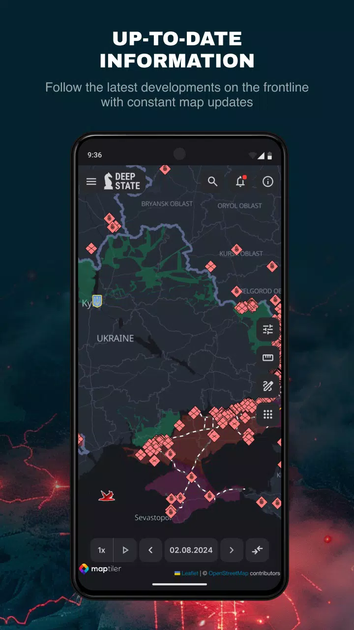
DeepStateMap.Live stands out as the definitive interactive online platform for tracking the hostilities in Ukraine. This map meticulously details the ongoing Russian-Ukrainian conflict, providing real-time insights into the locations and movements of Russian military units. Users can leverage the application's data caching feature, ensuring a seamless experience even in areas with intermittent internet connectivity.
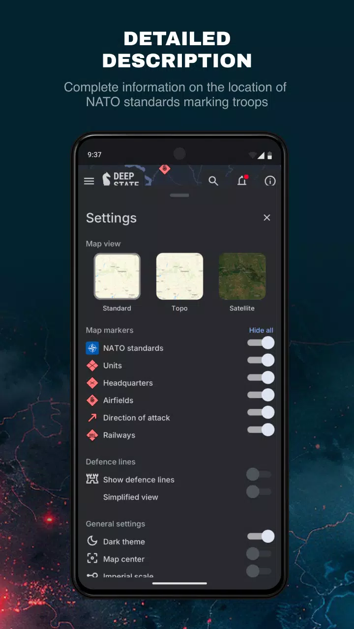
The map uses a comprehensive set of symbols to represent various aspects of the conflict:
- Territory of Ukraine liberated from occupation within the last two weeks
- Previously liberated territories
- Areas requiring further clarification
- Territories currently occupied by Russian forces
- The occupied regions of Crimea and ORDLO
- The territory of Transnistria
- Locations of Russian military units, referred to as "rashists units"
- Russian military headquarters
- Russian airfields
- Russian naval fleets
- Directions of Russian military attacks, labeled as "rashists attacks"
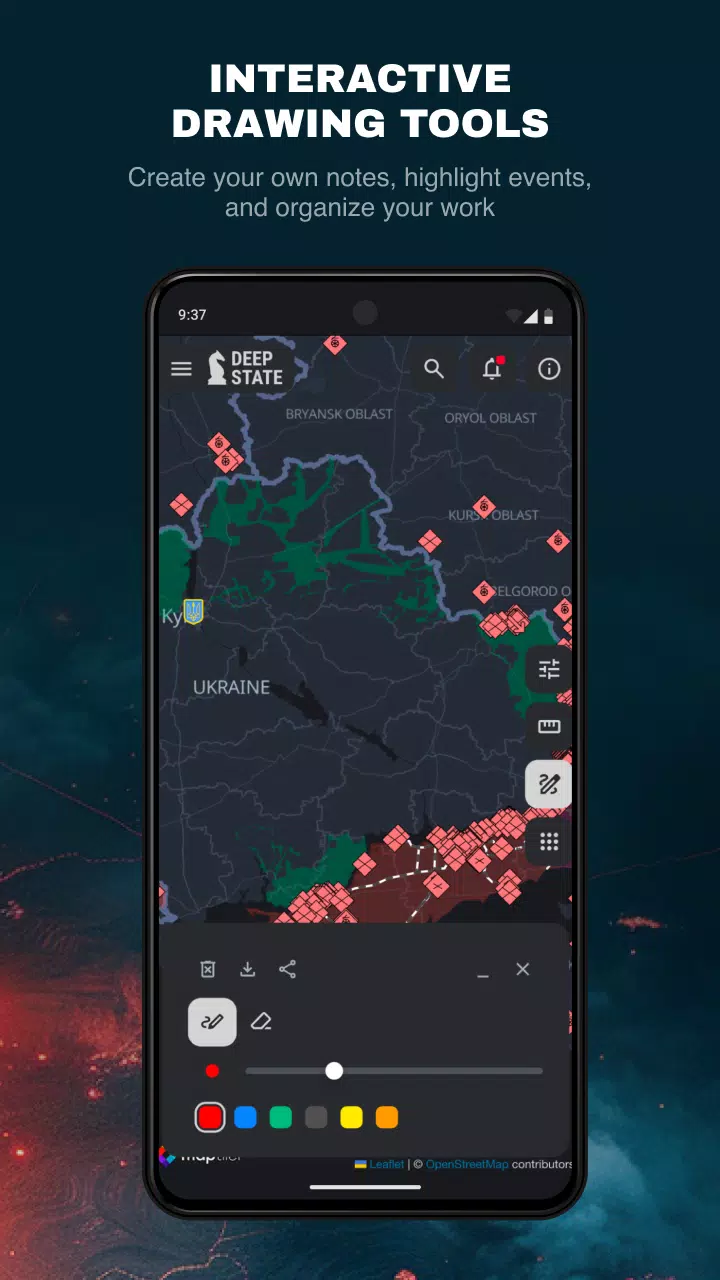
The map divides the territory into clearly marked zones, each colored to signify different statuses, with precise markings for Russian military units and airfields. Beyond the map itself, DeepStateMap.Live offers a dynamic news feed and tools to measure distances between any two points on the map. Additionally, users can activate an overlay showing fire points based on NASA Firms data, allowing for a comparison with the front lines. A specialized feature enables the measurement of artillery system ranges, such as HIMARS, M777, and CAESAR, across the entire front line.
What's New in the Latest Version 2.0.3
Last updated on Aug 13, 2024
DeepStateMap.Live's latest version, 2.0.3, includes minor bug fixes and enhancements. To experience these improvements, ensure you install or update to the newest version.