Introducing the definitive HEMAV app, designed to revolutionize how you monitor your fields directly from your mobile device. This powerful tool harnesses the capabilities of HEMAV LAYERS, utilizing Artificial Intelligence combined with drone and satellite technology to provide comprehensive agronomic reports and recommendations.
With the HEMAV app, you can effortlessly:
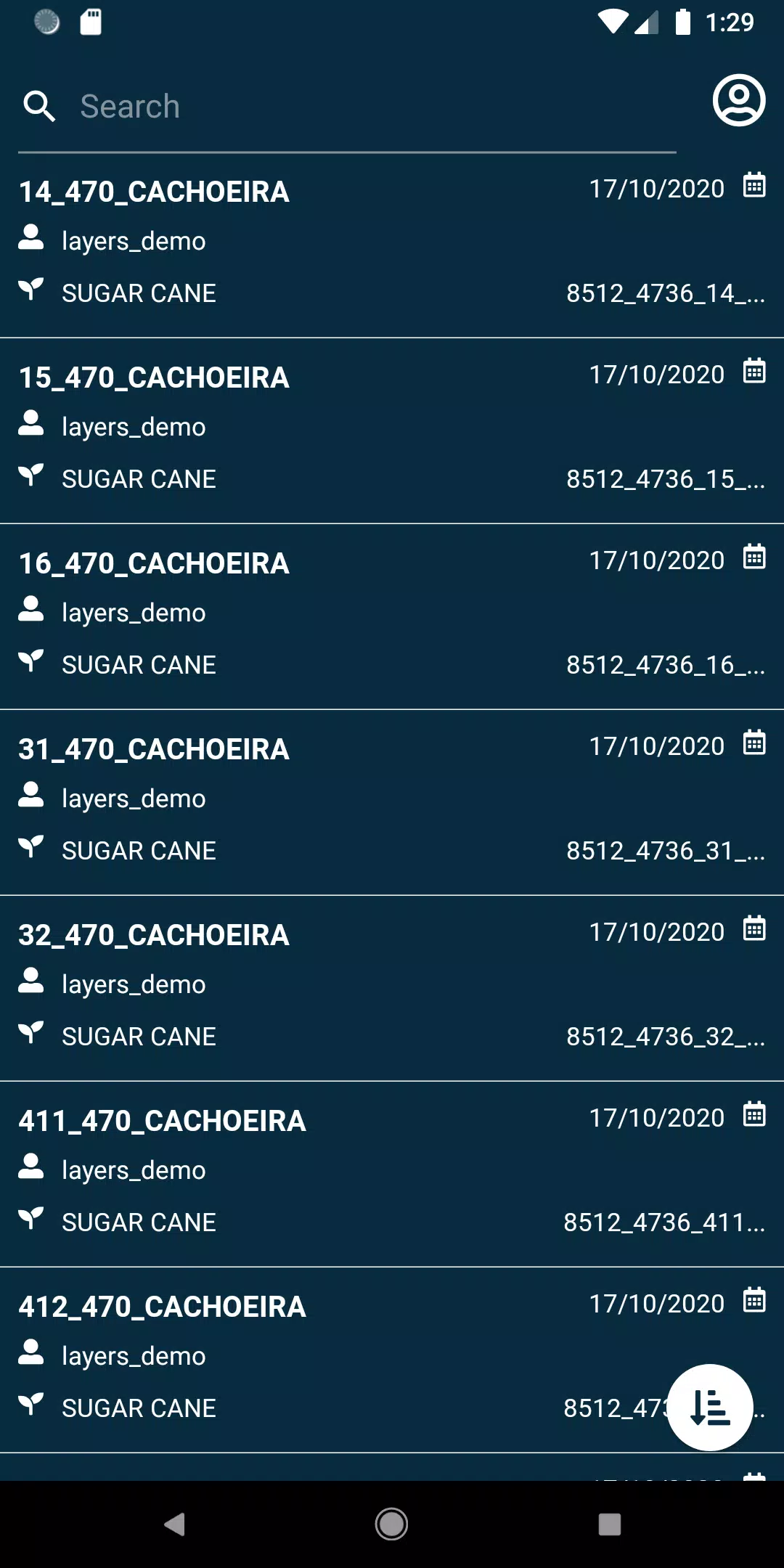
- View your fields with ease.
- Search for specific fields using a variety of filters to pinpoint exactly what you need.
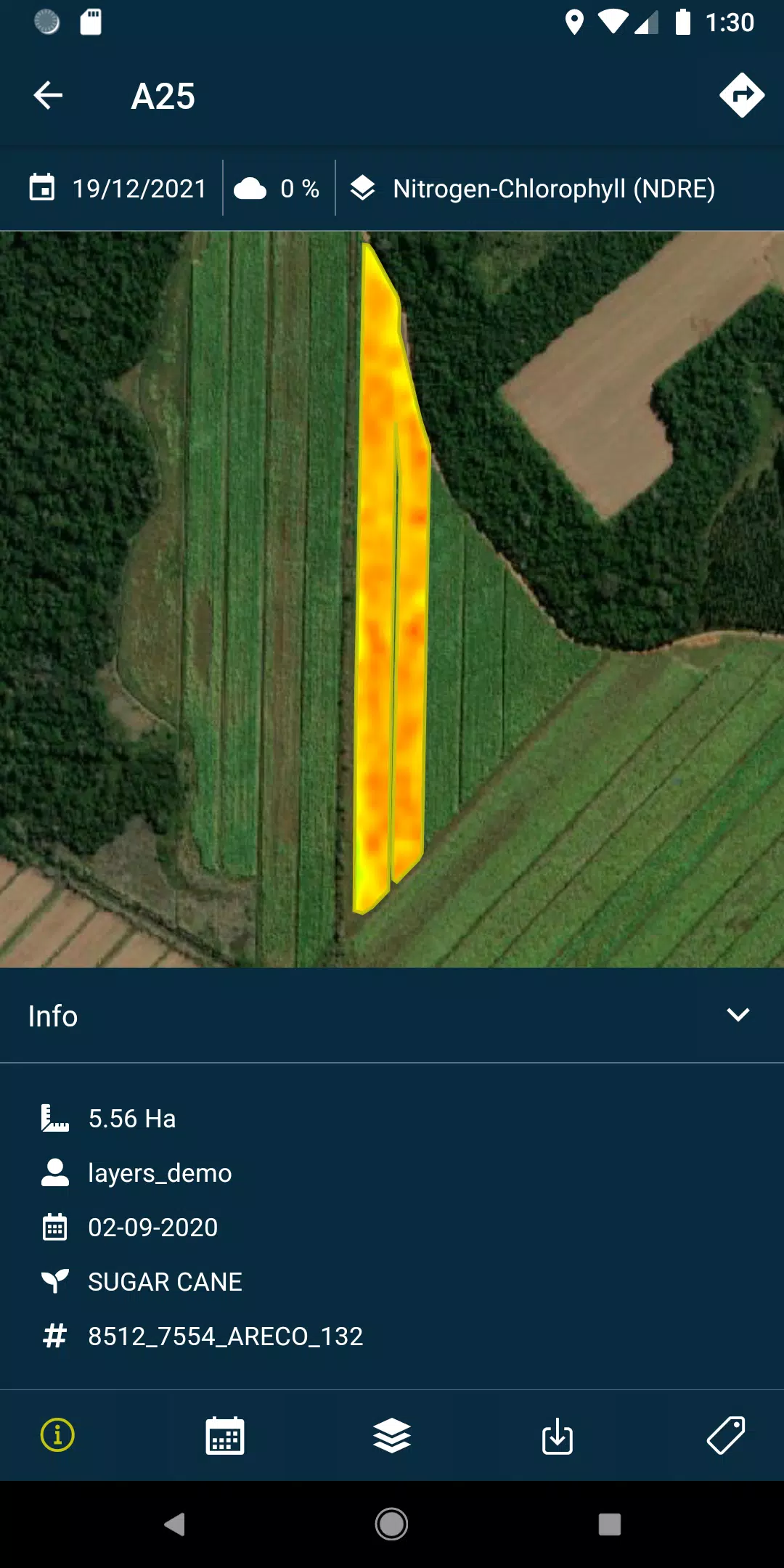
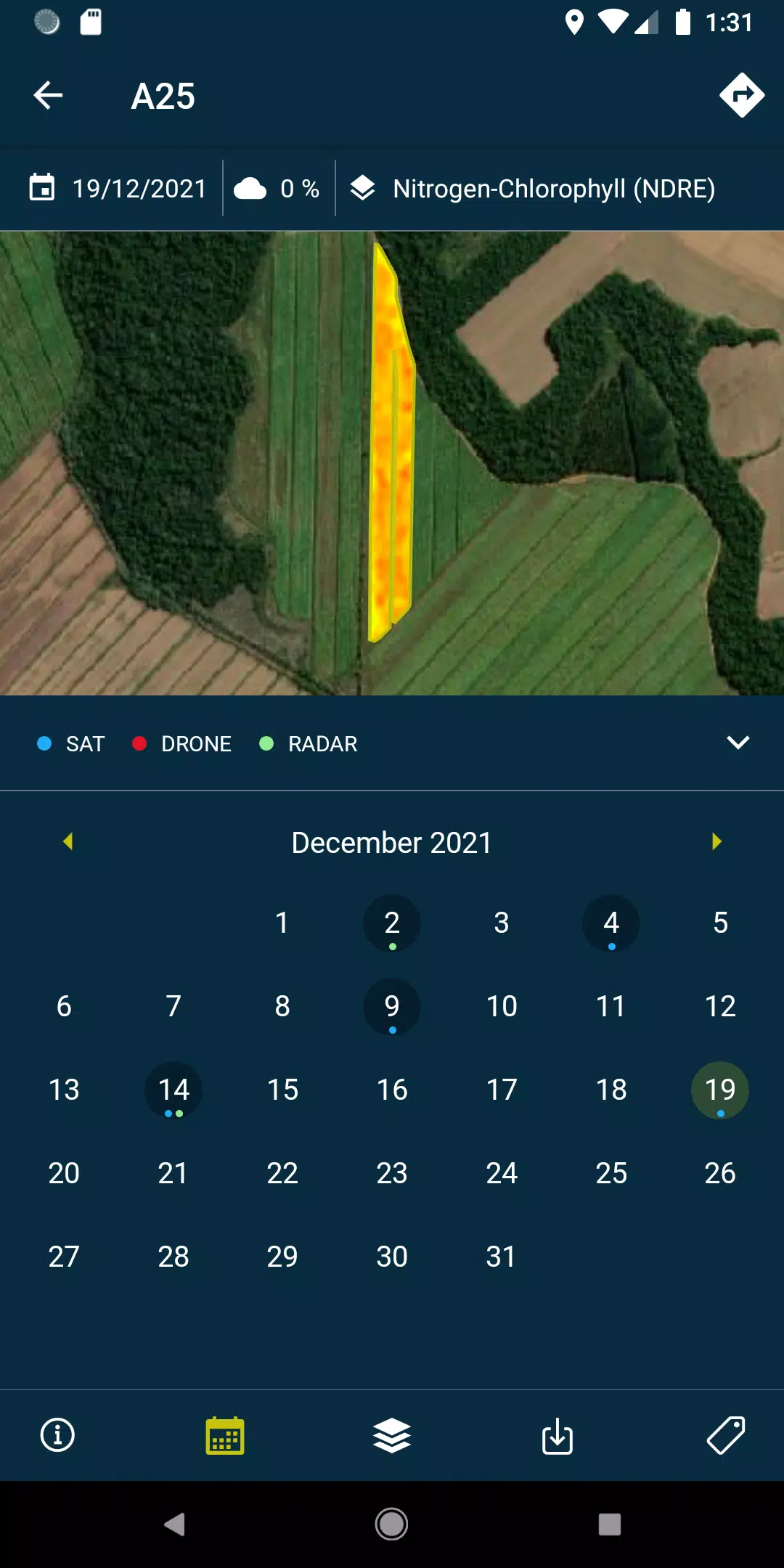
- Access layers, which include detailed reports and recommendations, along with PDFs generated from each drone flight or satellite pass over your fields. These can be viewed both online and offline for ultimate convenience.
- Capture field photos and geolocate them, enhancing your ability to monitor your fields meticulously. You can also add comments to these photos for a comprehensive record.
- Conduct field surveys and seamlessly integrate them into the HEMAV system for further processing and analysis.
Please note, to fully leverage the capabilities of this app, a subscription to HEMAV products is required.
About HEMAV Precision Agriculture Service
HEMAV's LAYERS software utilizes cutting-edge artificial intelligence to deliver precise agronomic recommendations. These insights are designed to optimize treatment applications and provide accurate crop production estimates, enhancing both production and quality levels in the agricultural sector.
What's New in Version 2.8.5
Last updated on Oct 19, 2024, version 2.8.5 includes essential bug fixes that address pending sample uploads and enhance cloud coverage filtering, ensuring a smoother and more reliable user experience.