Catch them all! The Peak Hunters application is your ultimate companion for mountain enthusiasts, offering the unique feature of offline maps for collecting peaks across various regions.
Supported locations include:
- Czech Republic
- Slovak Republic
- Austria
- Switzerland
- Slovenia
- Faroe Islands
- Italy - Sardinia and Sicily
- Portugal - Madeira
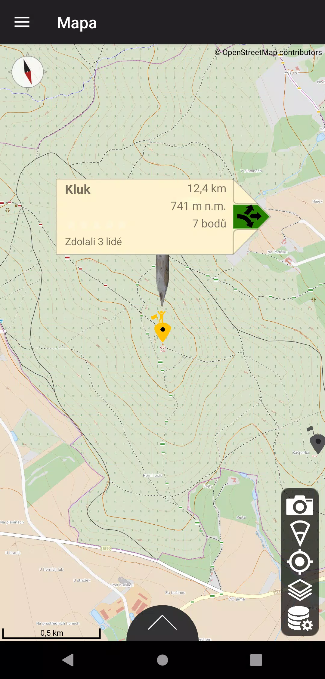
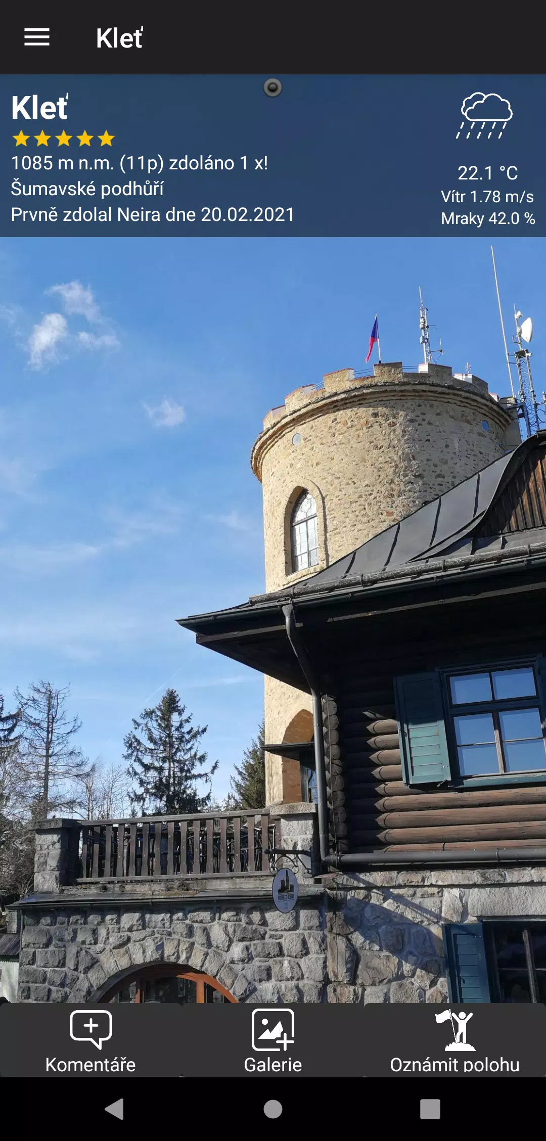
The Peak Hunters app boasts a continuously growing database of peaks, primarily from the Czech Republic and extending to neighboring countries. By leveraging your mobile phone's GPS, you can log your ascents and earn points based on the mountain's altitude and the difficulty of your climb. You can enhance your experience by adding personal ratings and photos to each peak you conquer. The app displays all peaks on a clear map, allowing you to filter them by country, mountain range, or proximity to your current location. To ensure functionality even in remote areas, you can download offline map data sourced from OpenStreetMap, which also highlights tourist routes.
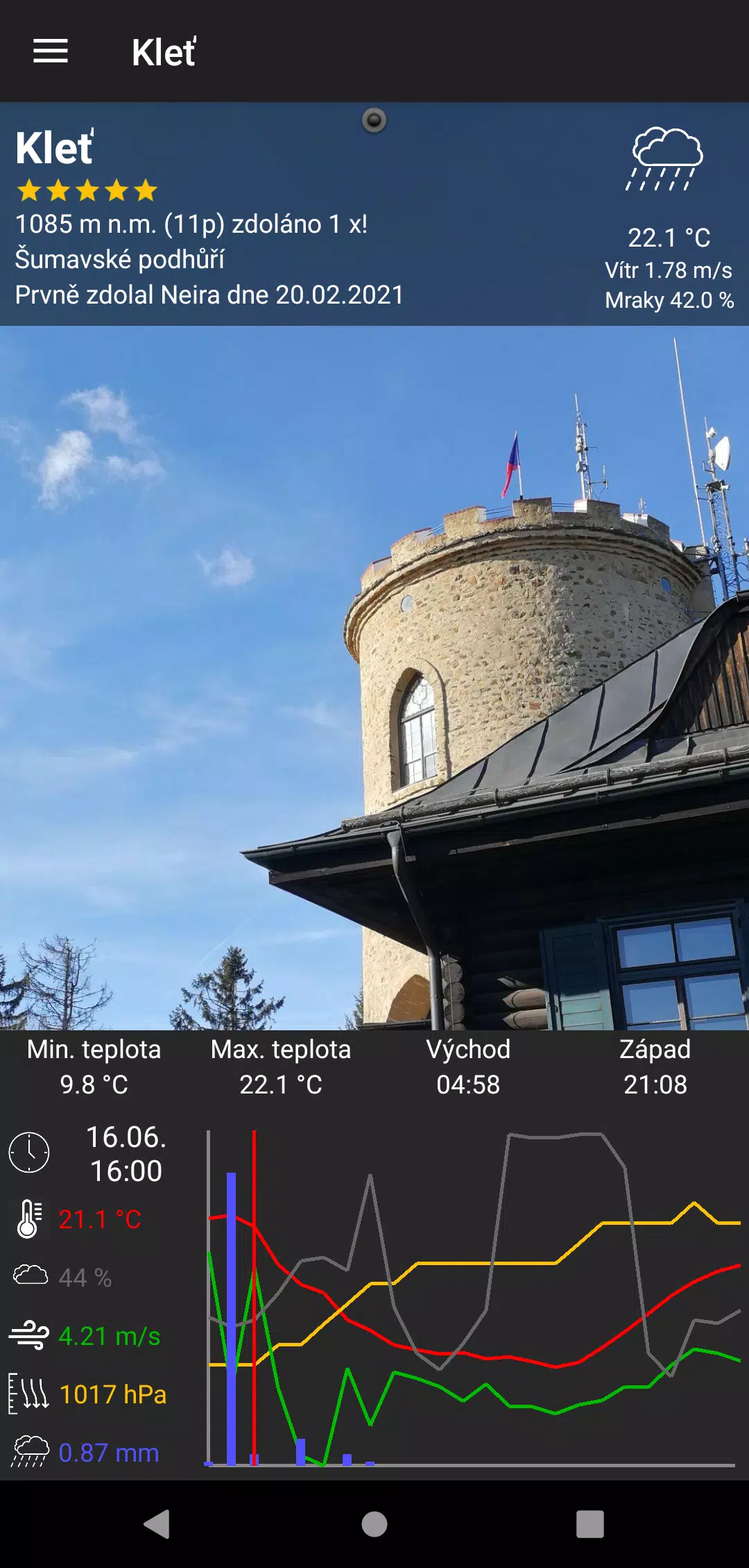
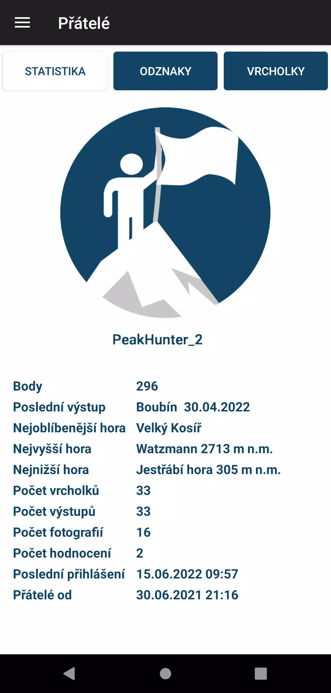
If you spot a peak missing from the database or plan to explore a new hill, simply long-press the location on the map to submit it for inclusion. Once approved, the peak will appear in the app, and you'll earn bonus points for your contribution. Peak Hunters also offers an expanding suite of statistics and collectible badges. Earn and retain badges, with special recognition for rare ones. For each peak, you can access real-time weather forecasts to aid your trip planning, with projections up to 48 hours ahead.
A standout feature of the app is its ability to identify mountain peaks by simply pointing your phone at them, provided the distance filter is correctly set. You can also use the app in an anonymous mode. In incognito mode, functionality remains the same, but you cannot transfer your profile to other devices, log out, or recover your profile if your device is lost or data is corrupted. We recommend testing the app in incognito mode before transitioning to a registered profile.
The application is ad-free and incurs no fees, born out of a passionate hiker's desire for a comprehensive peak collection tool with offline map capabilities. Users can manually switch between dark and light modes, a setting accessible via the user profile screen. Should you encounter any issues, miss features, or wish to offer feedback, you can reach out directly through the in-app form. Your feedback is invaluable to us. Note that there is no accompanying website; the app is fully functional on its own.
What's New in the Latest Version 1.8.3
Last updated on Oct 20, 2024
Minor bug fixes and improvements. Install or update to the newest version to check it out!