City routes, live traffic, transit routes, parking, offline maps, and navigation are all integral features of the 2GIS app, designed to enhance your urban exploration and daily commuting experience.
We are excited to announce that we have updated 2GIS. The previous version struggled to showcase the extensive information we have gathered about cities and businesses. With the new 2GIS, we have revamped the design, introduced a new search function, enhanced city updates, and integrated favorites with 2gis.ru for a seamless experience.
Services, Addresses, and Companies
2GIS is your go-to source for finding out which service providers are available in your area, locating district hospitals, post offices, and more. It assists in choosing cafes or service centers based on reviews and photos, displaying opening hours, and providing contact numbers for your convenience.
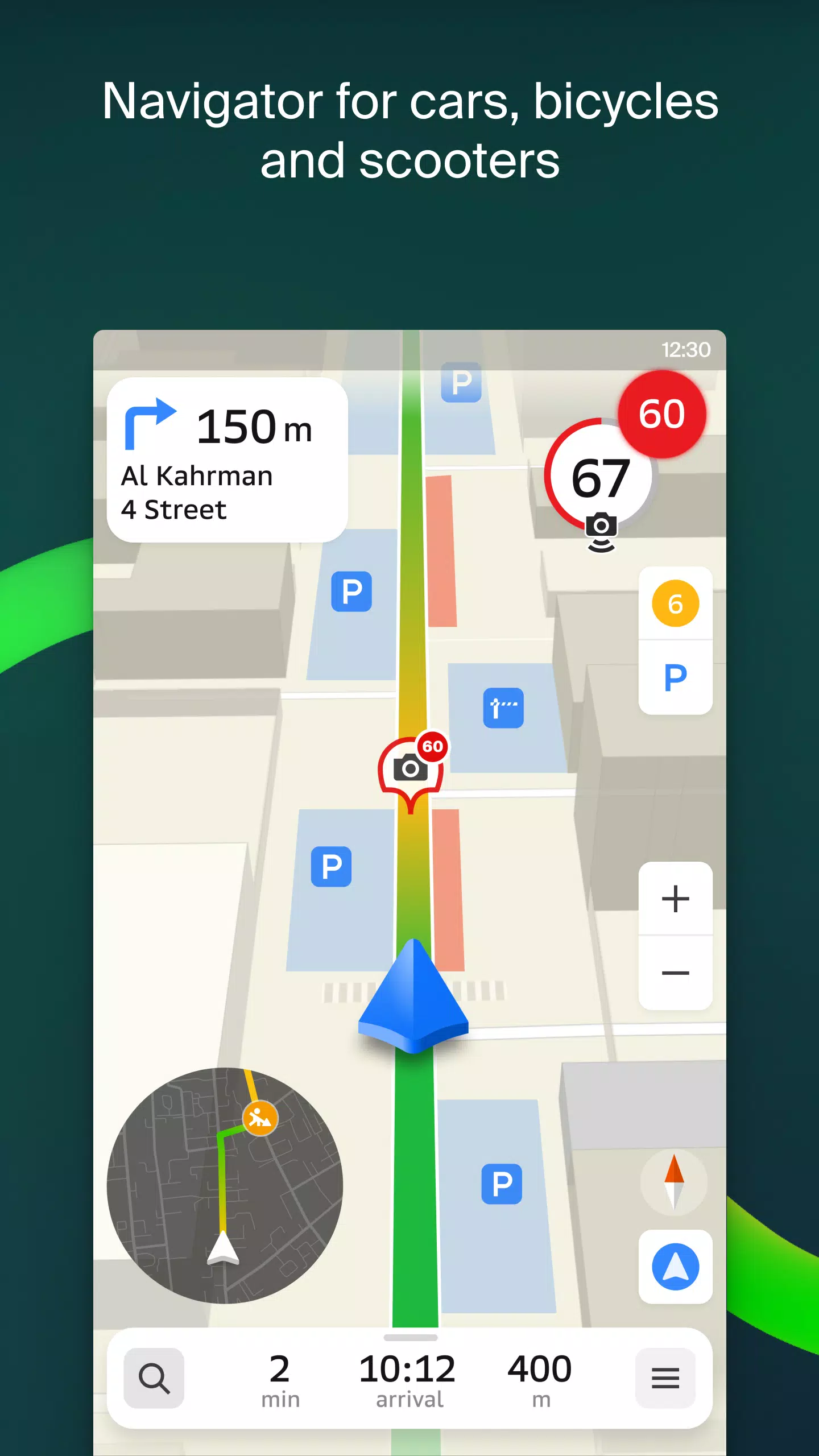
Transport and Navigation
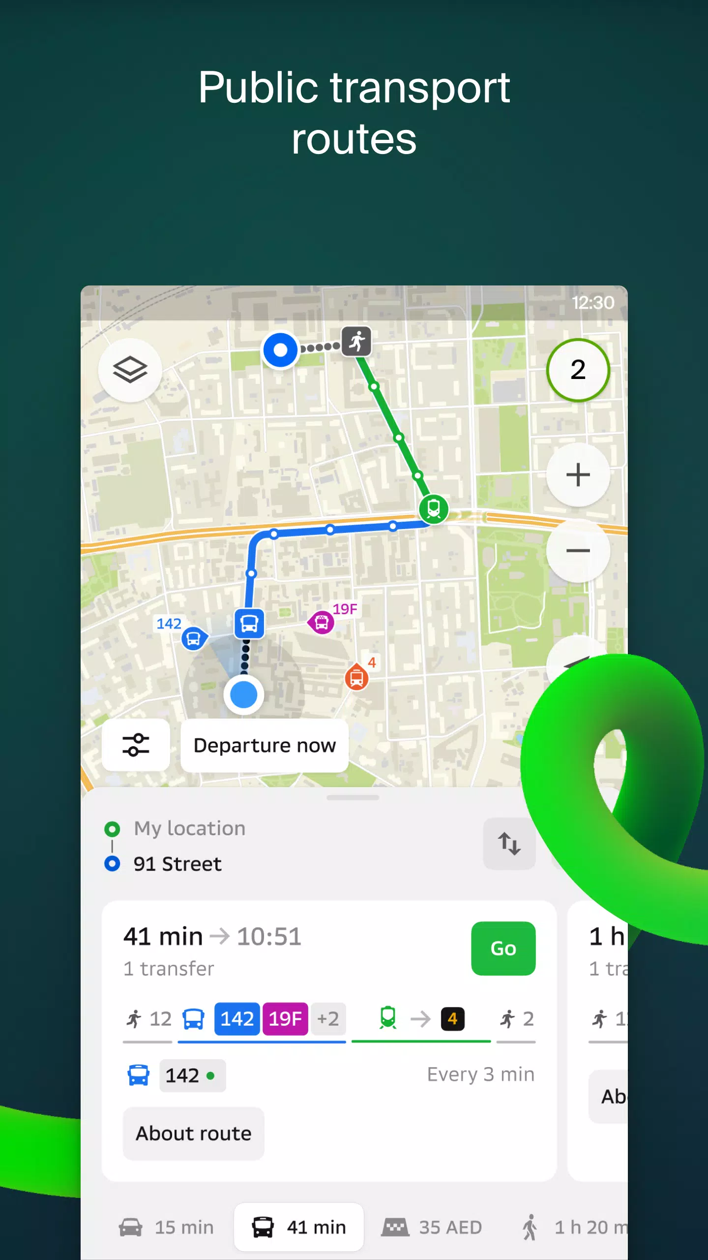
For drivers, 2GIS offers real-time voice-guided navigation, taking into account traffic jams and roadblocks. It dynamically adjusts your route if you deviate from the planned path. For pedestrians, the app provides options for traveling by buses, metro, trains, cable cars, and river trams, ensuring you reach your destination efficiently.
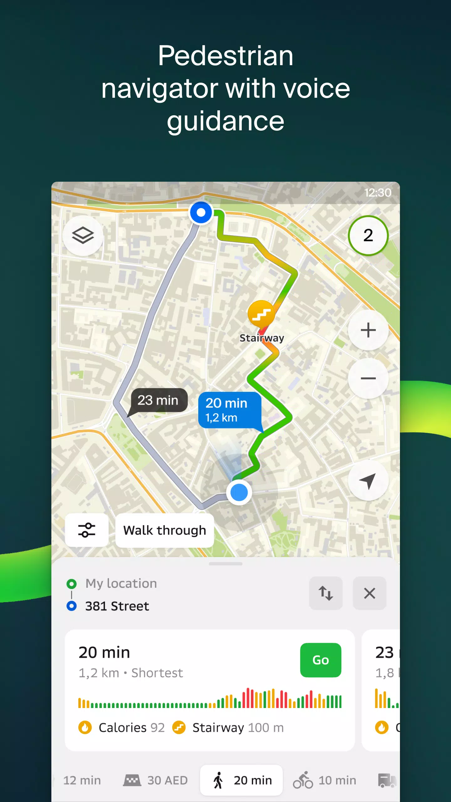
Walking Routes
Pedestrian navigation in 2GIS guides you on foot, working in the background and offering voice guidance to keep you on track.
Friends on the Map
With 2GIS, you can now track the real-time location of your friends and family on the map. You control who can see your location and manage your visibility settings as you see fit.
Building Entrances
Navigating to business centers is made easy with 2GIS, which provides detailed information on how to enter over 2.5 million companies. Whether you're using public transport or driving, the app will direct you right to the entrance.
Plans of Shopping Centers
Inside shopping centers, 2GIS helps you find everything from shops and cafes to ATMs and restrooms, allowing you to plan your visit in advance and save time.
2GIS Beta Notifications Companion App for Smart Watches
For users with Wear OS smartwatches, the 2GIS beta companion app offers a convenient way to navigate on foot, by bike, or public transport. It syncs with the main 2GIS beta app to display maps, provide maneuver hints, and send vibration alerts as you approach turns or bus stops. The companion app automatically starts when you initiate navigation on your phone and is compatible with Wear OS 3.0 and later versions.
By participating in the beta version, you'll receive the latest updates as we fix bugs and errors, contributing to the development of a new version that will soon be used by millions. You don't need to uninstall the original app; the beta version runs alongside it, allowing you to switch between them effortlessly.
For support, reach out to us at [email protected].
What's New in the Latest Version 6.44.1.559.3
Last updated on Oct 19, 2024
We're thrilled to share the latest enhancements in 2GIS version 6.44.1.559.3, designed to make your experience even better:
- Realistic Roads: Enjoy wide, realistic road displays on the main map and during route searches for a more immersive navigation experience.
- Chats for Friends: Stay connected with friends directly within the app, messaging each other without needing to exit the map view.
- Nearby Friend Alerts: Get notified when a friend is nearby, with the option to disable these alerts in the settings.
- Ski Lift Statuses: Perfect for the ski season, see the status of ski lifts on slopes to plan your day effectively.
- Walking Steps in Public Transport Routes: For routes involving public transport and walking, we now calculate and display the walking part in steps for better planning.