Navigate the world with ease using 2GIS, your comprehensive offline map and GPS navigation tool. Designed for both car drivers and pedestrians, 2GIS offers live traffic updates, public transit schedules, and a detailed city directory, ensuring you're always equipped, whether you're online or offline.
With 2GIS, you'll feel right at home even in unfamiliar territories:
- Quickly locate addresses, businesses, phone numbers, operating hours, products, or services.
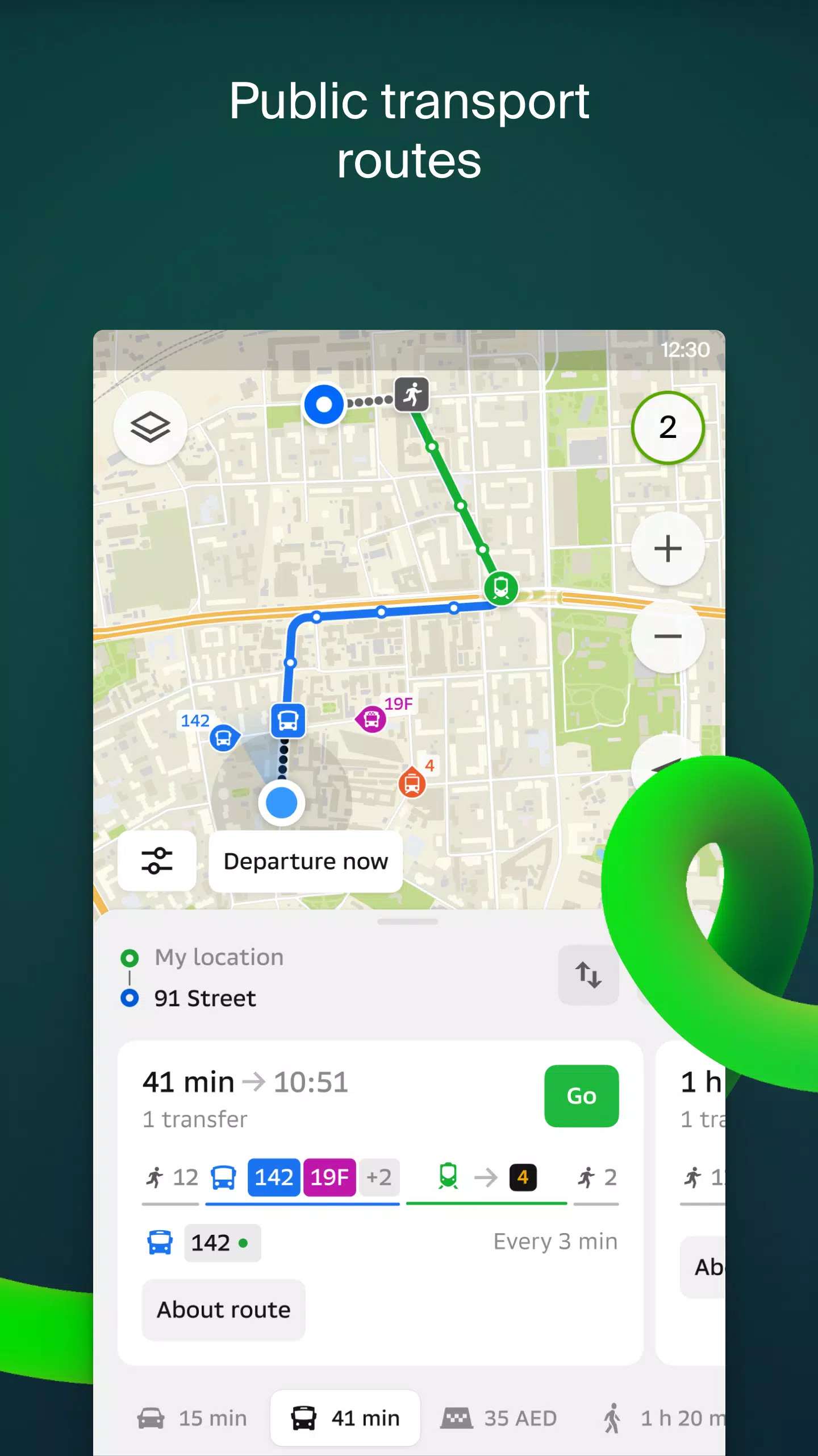
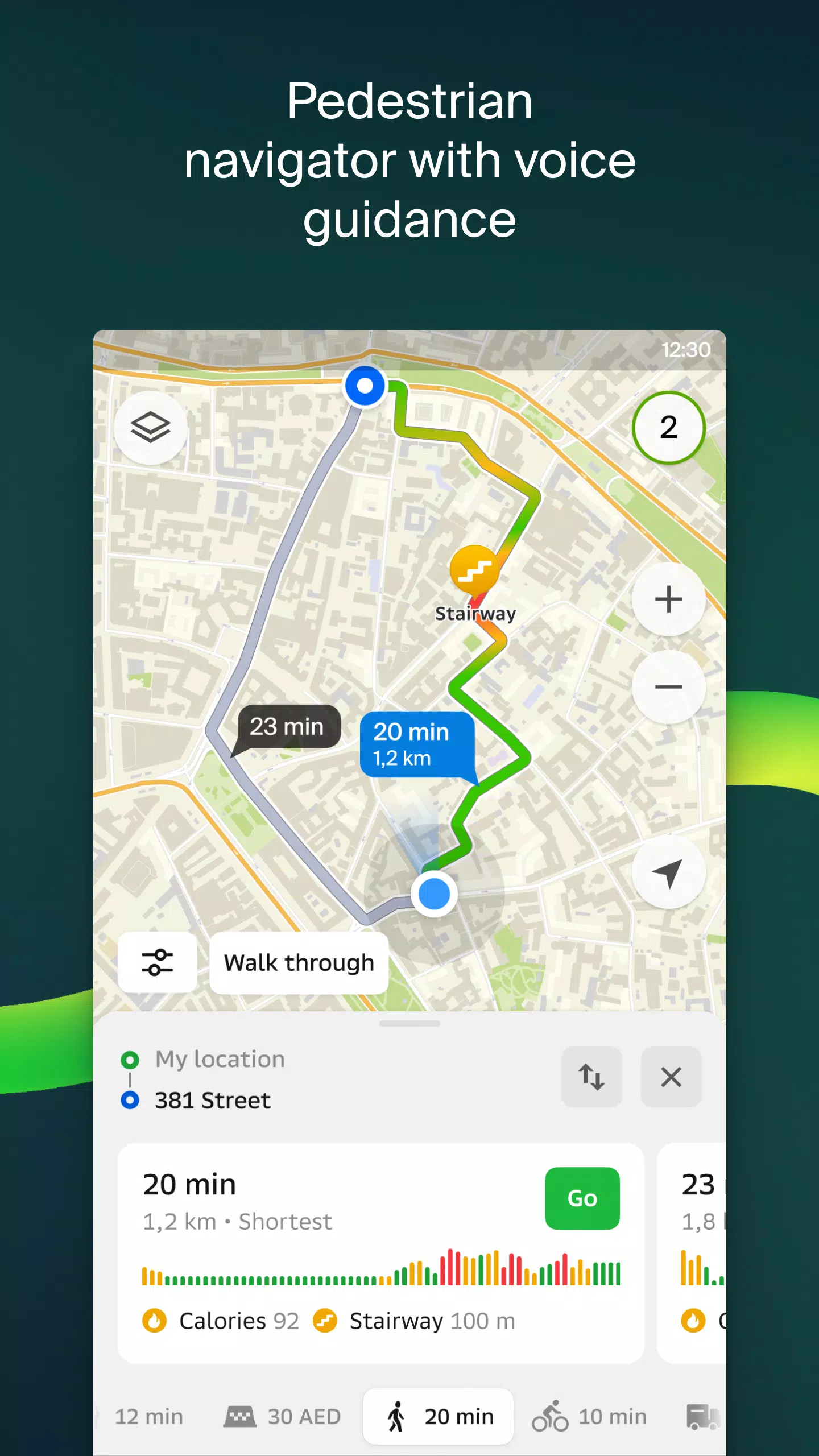
- Discover the best routes by car, bus, subway, or follow pedestrian navigation.
- Find building entrances and nearby parking options effortlessly.
Our maps are meticulously accurate, pinpointing districts, buildings, streets, bus stops, subway stations, gas stations, sports grounds, and countless other landmarks.
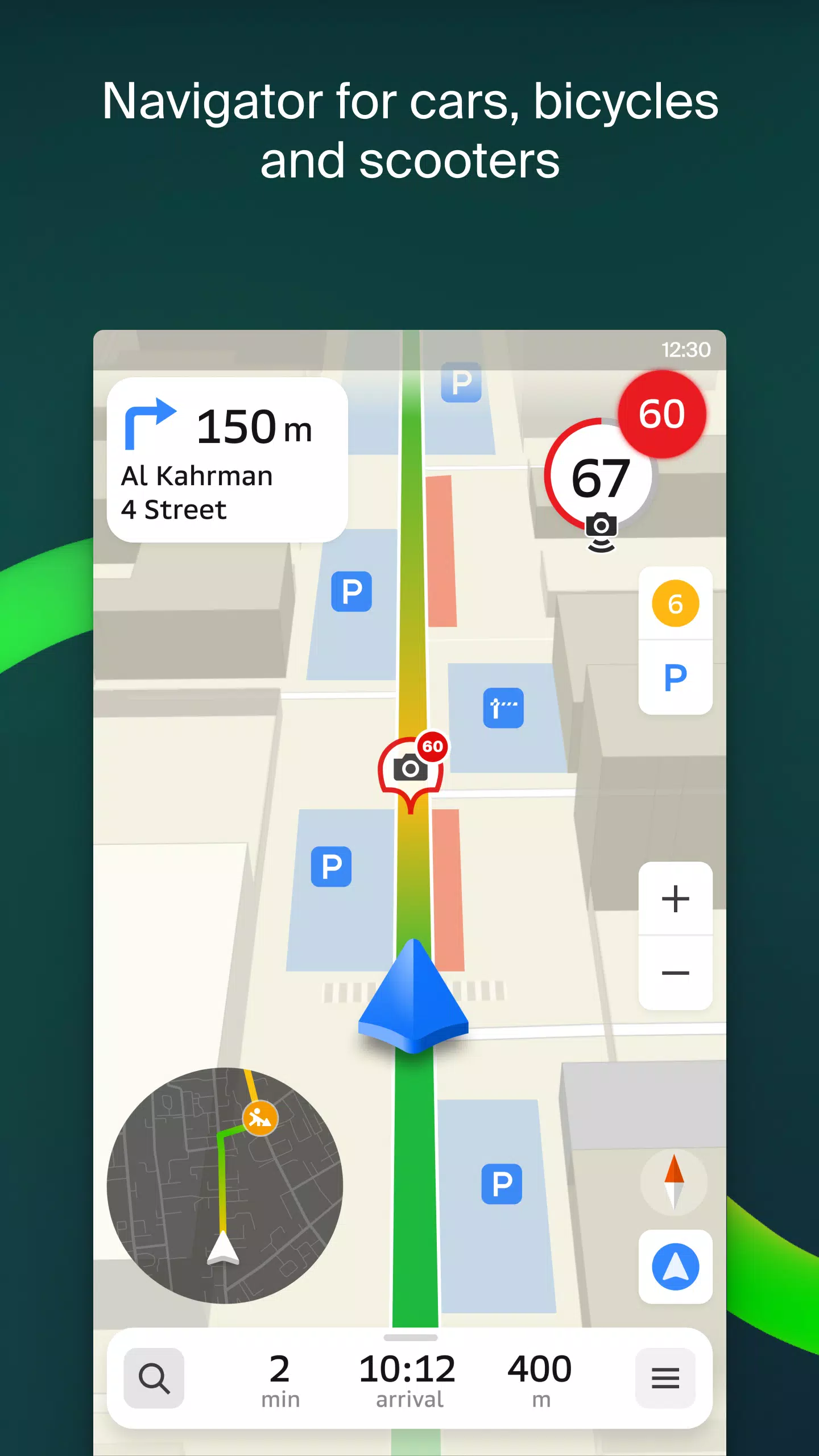
2GIS's GPS navigation takes into account real-time traffic conditions, road signs, speed cameras, toll roads, and unpaved routes, providing optimal routes for intercity travel and multi-stop journeys. Plus, it's compatible with Android Auto for seamless in-car navigation.
Stay connected with friends and family through our live location feature. Track your kids or friends for added safety, share fun stickers, and monitor battery levels. You control who sees your location and can adjust your sharing settings anytime.
Stay informed with real-time road events, including accident reports, street closures, and speed camera alerts, all integrated directly into the map.
For public transit users, 2GIS provides up-to-date schedules and online routes, ensuring you never miss a bus or train.
Pedestrians will appreciate our walking routes, offering background navigation with voice guidance to guide you wherever you need to go on foot.
Truck drivers can rely on our cargo navigation, tailored to the specific needs of your vehicle and cargo for the most efficient routes.
Explore more with our detailed directory, which includes addresses, entrances, postal codes, phone numbers, operating hours, social media links, and websites. Users can also contribute photos and reviews to enhance the community's knowledge.
Make the most of your travels with our travel guide feature, highlighting major attractions, Wi-Fi hotspots, and more, all plotted on the map.
Enhance your navigation experience with the 2GIS Notifications companion app for smartwatches on Wear OS. This app offers route guidance for walking, biking, or using public transport, complete with map views, maneuver hints, and vibration alerts as you approach turns or bus stops. It seamlessly integrates with the main 2GIS app and is compatible with Wear OS 3.0 and later versions.
Available Maps:
Cities of the UAE:
- Dubai, Sharjah, Abu Dhabi, Al Ain, Ajam, Ras Al Khaimah, Fujairah, Umm Al Quwain, Dibba Al Fujairah, Khor Fakkan, Kalba, Al Salamh, etc.
Cities of Russia:
- Moscow, Saint Petersburg, Novosibirsk, Ekaterinburg, Krasnoyarsk, Chelyabinsk, Ufa, Omsk, Kazan, Perm, Nizhny Novgorod, Sheregesh, etc.
Cities of Belarus, Kazakhstan, Uzbekistan, Azerbaijan, and Kyrgyzstan:
- Minsk, Pavlodar, Semey, Aktau, Aktobe, Almaty, Nur-Sultan, Bishkek, Karaganda, Kokshetau, Kostanay, Osh, Baku, Tashkent, etc.
For any support, reach out to us at [email protected].